When the Trail Vanishes: Staying Found When Tech Fails and the Map Runs Out
Somewhere around mile 8 on a remote stretch of the Wind River Range in Wyoming, a hiker named Derek pulled out his phone to check his position and found a black screen staring back at him. Dead battery. The trail — what little remained of it — had faded into a maze of elk paths and granite slabs about a quarter mile back. His paper map was in his car. His compass was at home, still in the box from Amazon.
Derek's story isn't unusual. It's practically a template.
As off-trail and lightly marked routes surge in popularity across the American West — think cross-country routes in the Sierras, unmarked high routes in Colorado, or any number of bushwhacking adventures in the Cascades — a growing slice of the hiking population is heading into genuinely complex terrain with exactly zero analog navigation skills. A 2022 survey by the American Hiking Society found that nearly 40 percent of respondents had never used a physical compass in the field. Ever. Not once.
That number should make every serious backcountry traveler a little uncomfortable.
The GPS Dependency Problem Nobody Wants to Admit
GPS apps like Gaia, AllTrails, and CalTopo are genuinely excellent tools. Nobody here is going to tell you to leave your phone at the trailhead. But tools have failure modes, and the failure mode for a smartphone is brutally unforgiving: cold temperatures, battery drain, satellite gaps in deep canyons, and the simple reality that a touch screen becomes useless in driving rain or with gloves on.
The bigger issue is psychological. When you've been navigating exclusively by a blue dot for three or four years of hiking, your brain quietly stops processing the landscape as information. You stop noticing which ridge you crossed, which drainage you followed, which direction the afternoon sun was tracking. You outsource your spatial awareness to a device — and when that device disappears, you're not just without a tool. You're without a skill set.
This is the real danger. Not the dead phone itself, but the atrophied instincts that go with it.
Start With the Compass (No, Really)
A baseplate compass costs about $15 and weighs almost nothing. Learning to use one takes an afternoon in your backyard, not a wilderness course. Yet most hikers treat compass literacy like a quaint relic — something their grandfather needed before satellites existed.
Here's the core skill worth drilling until it's automatic: taking a bearing and following it.
Point your direction-of-travel arrow toward your destination (or a landmark in that direction). Rotate the compass housing until the orienting arrow lines up with the magnetic needle — the classic "red in the shed" alignment. Read the degree number at the index line. Now you have a bearing. Walk it. Check it every few minutes. Adjust for declination if you're in an area where magnetic north and true north diverge significantly — and in much of the American West, that difference can be 10 to 15 degrees, which adds up fast over a mile of travel.
Practice this at home. Practice it on trails you already know. Make it boring and routine before you ever need it to be critical.
Reading the Land Like a Language
Compass skills matter, but the real upgrade is learning to read terrain as a continuous stream of navigational data. Every landscape is telling you where you are if you know what to listen for.
Ridgelines are your friends. They're visible from a distance, they don't move, and they appear on every topo map as tightly clustered contour lines. If you can identify the ridge you're standing on and find it on your map, you've anchored yourself to reality in a way no GPS signal can improve upon.
Drainages work the same way in reverse — water always flows downhill, and following a drainage will eventually lead you to a creek, a valley, or a road. In the American West especially, this is often a legitimate bail-out strategy when you're genuinely disoriented.
Sun position is underused by modern hikers. In the continental US, the sun rises roughly in the east and sets roughly in the west — obvious, yes, but surprisingly grounding when you're turned around in dense forest. In the northern hemisphere, solar noon (when shadows are shortest) puts the sun due south. This gives you a rough directional anchor even without a compass.
Vegetation patterns can also carry information. In the Rockies and Sierra Nevada, north-facing slopes hold snow longer, grow denser timber, and often look noticeably different from south-facing slopes. If you know which aspect you're supposed to be on, the plant life around you can confirm or contradict your position.
The Psychology of Getting Lost
Here's the thing nobody puts in the gear lists: panic is a navigation problem.
When people realize they're disoriented, the brain's threat response kicks in fast. Heart rate climbs. Thinking narrows. The urge to move — anywhere, just move — becomes almost overwhelming. And that urge is exactly what turns "temporarily confused" into "genuinely lost."
Search and rescue professionals will tell you the same thing every time: stop moving the moment you realize you're uncertain of your position. Sit down. Drink some water. Give yourself five minutes to reconstruct your mental map before you take another step. When did you last know exactly where you were? What landmarks did you pass? Which direction were you traveling?
This sounds simple. Under stress, it is extraordinarily hard to actually do. Which is why it's worth practicing the mental habit on easy trails, in low-stakes moments — building the reflex of pausing and thinking before reacting.
Carrying a small whistle and knowing the universal distress signal (three blasts, pause, repeat) is also just basic backcountry literacy. If you're truly stuck and need help, conserving energy and signaling beats wandering every time.
What to Actually Carry
The analog navigation kit doesn't need to be complicated:
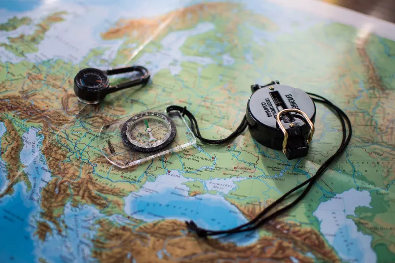
- A baseplate compass with a rotating housing and clear base plate (Suunto and Silva both make reliable options under $25)
- A printed topo map of your specific area, ideally waterproofed or stored in a zip-lock
- A pencil for marking your last known position
- A fully charged battery pack for your phone — even a small 5,000 mAh unit buys you significant extra runtime
None of this is heavy. None of it is expensive. All of it is the difference between a story you laugh about at the trailhead and a story that ends with a helicopter.
The Skill That Doesn't Go Dead
There's something quietly satisfying about navigating by map and compass on a trail that doesn't show up on any app. Following a bearing across an open basin, hitting the saddle you were aiming for, confirming your position by two visible landmarks — it's a different kind of confidence than watching a blue dot move across a screen.
The backcountry doesn't care how many miles you've logged on AllTrails. It doesn't care about your gear list or your summit count. What it responds to is attention — the practiced habit of reading the land, checking your heading, and staying oriented to where you actually are.
Learn the analog skills. Carry the tools. And the next time your phone goes dark at mile 8, you'll already know what to do.