| |
Goffs
Goffsswas apparently the temporary location of the 7th Infantry Division. was apparently the temporary location of the 7th Infantry Division.
Goffsswas a railhead where the army leased portions of the track and built
additional tracks. was a railhead where the army leased portions of the track and built
additional tracks.
| |
|
|
|
|
|
|
| |
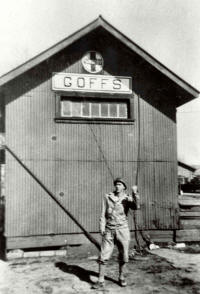
Soldier thumbin' a ride at Camp Goffs (1943). |
|
|
|
Tanks on flat-cars and on field to the right at Camp Goffs
(1943).
|
|
| |
|
|
|
|
|
|
Goffs was apparently the temporary location of the 7th Infantry Division.
Goffs was a railhead where the army leased portions of the track and built
additional tracks. There were several temporary buildings used by the army
at Goffs, including one at the campsite. The actual campsite could not be
found, although the
 foundations of several buildings remain immediately east
of Goffs. Goffs was the location of the 58th Quartermaster Regiment
beginning sometime in 1942. The 58th, like other units, was stationed in
pup tents. The unit was located somewhere adjacent to the siding. [1 pp:
128] foundations of several buildings remain immediately east
of Goffs. Goffs was the location of the 58th Quartermaster Regiment
beginning sometime in 1942. The 58th, like other units, was stationed in
pup tents. The unit was located somewhere adjacent to the siding. [1 pp:
128]
Goffs consisted of a railroad siding, ammunition storage area, and a
campsite. The War Department leased an area of track from the Santa Fe
Railroad and constructed 2,675 feet of tracks branching off of the leased
track. The site was used by the 7th Infantry Division at some time. Established in 1942, the site also included three administration buildings
(100 by 20 feet), two warehouse buildings (96 by 40 feet), and two sheds (96
by 40 feet). A temporary building measuring 100 by 20 feet was located 1
mile east of the siding and represented the location of the campsite. Ten
ammunition-storage igloos were located near
Goffs Butte. The 198th Ordnance
Battalion Headquarters with the XV Corps was stationed at Goffs for an
unknown length of time. [1 pp: 133]
 Current Condition Current Condition
Little can be found today indicating the presence of a camp at
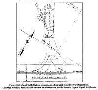
Goffs. Figure 138 (above) is a map of the Goffs area. The remains of
the siding can be seen, as can associated refuse. There is otherwise
no trace of the tent camp that existed at Goffs.
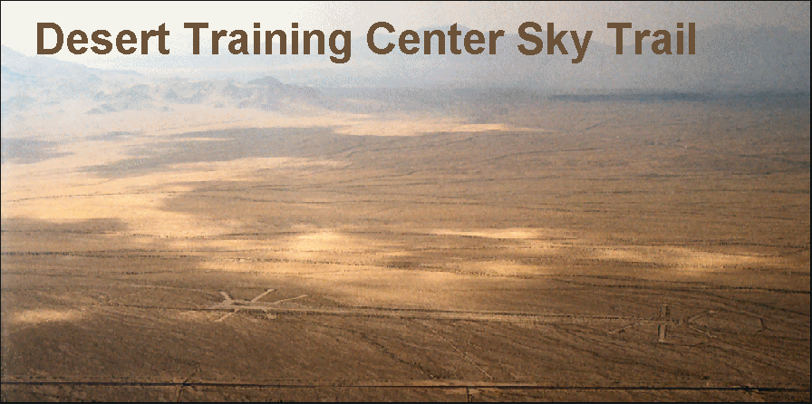
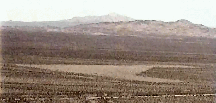
There are two airstrips at Goffs. The photograph of Goffs
Intermediate Field, at the left, was taken
May 22, 1998, and shows what remains of the airstrip today.
The Goffs Intermediate Field was triangular in layout, and it is still
faintly visible today.
Click the photograph to view a satellite image of the
Goffs Intermediate Field
Camp Goffs Army Airfield, a northeast-southwest oriented 1,500' strip,
was located about two miles west of triangular Goffs Intermediate Field.
Goffs Army Airfield is still visible also.
U.S. Army Corps Of Engineers Narrative:
Named after a railroad
official, Goffs became an important railroad siding on the Atlantic and
Pacific Railroad in 1883. A two-story station and turntable for the helper
engines that pulled trains up the long grade from Needles were built. The
population fluctuated during the mining and railroad eras, and today only a
few homes remain.
Goffs Rail Head and Campsite
In 1942, the War Department acquired, through five leases, approximately 426
acres for Goffs Campsite. It is likely that leases were secured from the
Department of the Interior and a variety of private parties, including the
Atchison, Topeka, and Santa Fe Railway Company. Within the organization of
the Desert Training Center, Goffs Campsite is not listed as one of the
divisional camps. However, according to local historian and land owner,
Dennis Casebier, the entire 7th Infantry Division, consisting of 15,000
troops, trained at this location. Goffs provided a rail head, ammunition
storage area, campsite, and air strip, all located in an undeveloped region
of San Bernardino County, California, approximately 35 miles west of
Needles, California. The exact location of the Goffs Campsite cannot be
determined, but it could lie on either side of the railroad, east of the
former rail head area. The rail head diverted freight from the passing track
of the Atchison, Topeka and Santa Fe Railway into a leased area measuring
200 feet by 1,320 feet, and containing 990 feet of track. An additional
2,675 feet of track, which branched off the leased rail head, were
constructed by the government. This rail head area supported two sheds and
two warehouses, each providing 3,840 square feet of floor space.
Unlike other, more substantial camps of the CAMA, Camp Goffs was a
small, improvised field encampment. It consisted primarily of the Goffs
Railhead, with a surrounding encampment, the Goffs Army Ammunition Depot #4,
and the Goffs Rifle Range. The prewar Goffs civil airfield was apparently
reused as a military field, as a 1998 Army Corps of Engineers report on Camp
Goffs includes the statement that "Goffs also had a 1,500' x 150'
sand/gravel landing strip about two miles to the east (Army Ground Forces
1943)."
Another area associated with the campsite is located about 1 mile east of
Goffs, but its exact whereabouts could not be determined. An ammunition
storage area, located three miles to the south of Goffs, near the base of
Goffs Butte, supported ten ammunition storage igloos.
Another areas was devoted to the actual campsite. The exact location and
boundaries of this campsite could not be determined, but photographic
evidence, personal interviews, and investigation of the site indicates that
the campsite was located on either side of the railroad, to the east from
the rail head area. This campsite supported three administration buildings
each encompassing 6,000 square feet. There is no record of any other
temporary or permanent facilities being constructed on the site. Real estate
information indicates that another building was placed one mile east of
Goffs. However, there is no evidence which indicates how this building was
used.
The tracks and buildings associated with the rail head have all been
removed. However, the rail alignment leading from the main tracks, can still
be discerned. Railroad ties, spikes, and connecting hardware are still
scattered along the former rail head route. From a distance, the former
location of the warehouses and sheds can also be identified.
Aerial photographs, taken during military use of the campsite area, indicate
that the encampment area was located on either side of the main railroad
tracks. A portion of the campsite north of the tracks is on property now
owned by Mr. Dennis Casebier. During a sit survey, Mr. Casebier pointed out
a number of empty fuel drums, scattered ration cans, broken bottles, and
rubbish still on his property. On adjacent public lands on either side of
the railroad there are rock alignments and asphalt pads typically associated
with the other Desert Training Center camps. Several owner-occupied home
sites are now scattered throughout this area.
At a two acre residential area, supporting three trailers, located less than
one mile directly south of the former rail head/encampment area, a long
concrete foundation was found that could have supported one of the
structures used by the military during desert training. Aerial photographs
of the campsite confirm this claim and suggest that this structure may have
been one of the administration buildings associated with Goffs Campsite. Real estate information states that another building was constructed
approximately one mile to the east of Goffs. However, the remains of that
building could not be found.
Three miles south of Goffs is a rock-lined area immediately to the west of
Mountain Springs Road and near the southern base of
Goffs Butte. The layout
of this area resembles a typical Desert Training Center location. War
Department documentation indicates that ten ammunition storage igloos were
located in this area.
An incident report, dated 15 September 1980, supports the evidence that this
was an ammunition storage area. Approximately 200 ordnance items were found
on 28 April 1980, not far from the rock-lined area, by San Bernardino
Sheriff's deputies associated with the Search and Rescue Team. The area
where the ordinance was found is fairly level desert terrain which lies
below
Goffs Butte. However, the exact location of the ordinance dump site
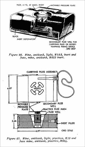
was not disclosed. The ordnance items included land mines, practice mines,
rifle grenades, rockets, and practice rockets. According to the report, this
ordnance had been buried during the war and was apparently uncovered by the
effects of rain and erosion. Representatives from the Explosive Ordnance
Detachment at Fort Irwin, the Bureau of Land Management, and a local
construction company from Needles began to remove the materials. The project
took two days to complete and ultimately recovered 80 tons of explosive
material including 43 expended 2.36" practice rockets, 51 M19 rifle
grenades, and 67 empty M1 practice D-P land mines were uncovered during
recovery operations. The materials were subsequently transported to a BLM-owned
site and reburied. The original site was left free of ordnance and graded to
conform with the natural landscape.
[1] The Desert Training Center/California-Arizona Maneuver
Area,1942-1944 HISTORICAL AND ARCHAEOLOGICAL CONTEXTS; Matt C. Bischoff
[2] The 369th Engineer Regiment _SS_
Return
to top of page
|
|
 foundations of several buildings remain immediately east
of Goffs. Goffs was the location of the 58th Quartermaster Regiment
beginning sometime in 1942. The 58th, like other units, was stationed in
pup tents. The unit was located somewhere adjacent to the siding. [1 pp:
128]
 Current Condition