The Desert Center Army Airfield was first known as the Desert Center Airdrome and was operational beginning sometime in the winter of 1942-1943. The airfield was a subbase of Thermal Army Airfield (now KTRM, Jacqueline Cochran Regional Airport) and served as a support base for the Air Technical Services Command. A detachment of the 475th Base Headquarters and Air Base Squadron was assigned to the base in January 1943. In August 1943, the Third Airdrome Detachment was created and assigned to the airfield, which had been designated the Desert Center Army Airfield sometime prior. The detachment was made up of pers
 onnel
from the deactivated
475th Base Headquarters and Air Base Squadron, and
consisted of 4 officers and 53 enlisted men. Commanded
by Maj. William B. Horton, the Third Airdrome
Detachment was placed in charge of the operation
of the airfield (U.S. Army Air Corps 1944:1; U.S. Air Force Historical Division n.d.b.: 2).
onnel
from the deactivated
475th Base Headquarters and Air Base Squadron, and
consisted of 4 officers and 53 enlisted men. Commanded
by Maj. William B. Horton, the Third Airdrome
Detachment was placed in charge of the operation
of the airfield (U.S. Army Air Corps 1944:1; U.S. Air Force Historical Division n.d.b.: 2).The airport contained two paved runways, each measuring 5,000 by 150 feet, along with taxiways and a parking apron. More than 40 buildings were constructed at the airfield, including an operations building, power house, control tower, pump house and well, and a 10,000-gallon water tower. Several other buildings (barracks and showers) were constructed previously by the Civilian Conservation Corps (CCC) and moved to the airfield during the war. Other buildings included officers quarters, mess hall, dispensary, headquarters, operations, recreation hall, link trainer building, hangar, and various supply buildings.
When the DTC/C-AMA closed in April 1944, the airfield was assigned to the Fourth Air Force, and operational activities decreased greatly. The airfield remained open, however, and was used by B-24 crews flying training missions from March Field (U.S. Air Force Historical Division n.d.b.:1).
In 1946, the airfield was turned over to the U.S. Army Corps of Engineers, and the buildings were auctioned off to the public. The airport then operated under private hands, although most of the buildings were dismantled. Some of the buildings were later relocated to Chiriaco Summit. Today, the airport is owned by Riverside County and leased to private users.
 Map of the locations of cultural artifacts at Desert center |
 Station hospital |
 Desert Center Evacuation Hospital site |
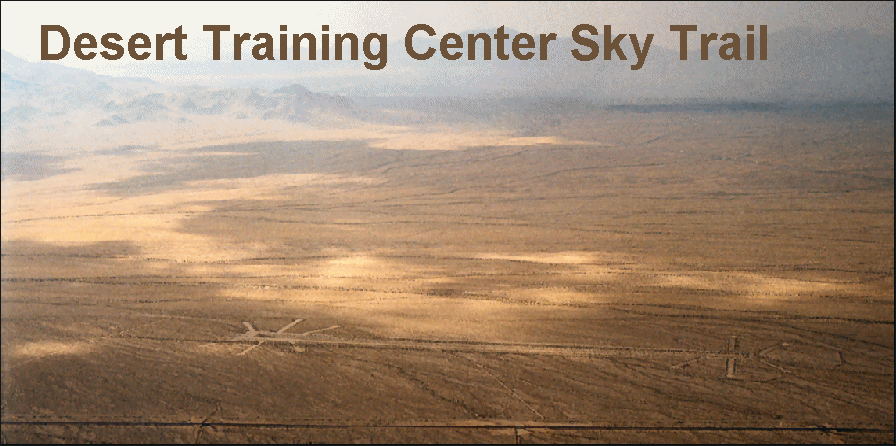
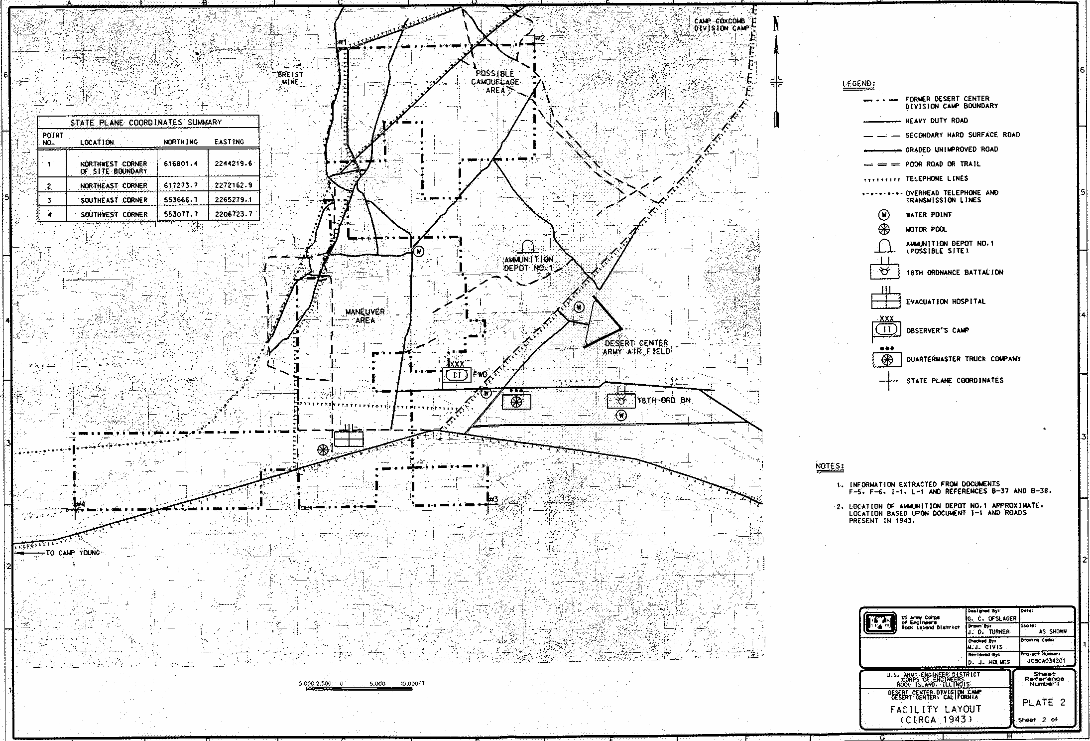
Camp Desert Center
Little is known about Camp Desert Center. Evidence
for its existence includes a use permit issued by the
secretary of the interior to the War Department, dated
April 1942. The permit references a divisional camp,
and included land within Township 5 South, Range 14
East, Sections 26, 28, 30, 32, and 34; and Township 4
South, Range 15 East, Sections 1-15, 17, 18, 22, and
30-34 (Ickes 1942:1-2). Approximately 34,000 acres
were acquired by the War Department for the camp
through either leases or transfers. The land is located
along the north side of current Interstate 10, between
Chiriaco Summit and Desert Center, and includes
land immediately to the east of Eagle Mountain Road.
The installation reportedly consisted of a maneuver
area, as well as an encampment with temporary
housing structures (U. S. Army Corps of Engineers
1993 :3). An
evacuation hospital, observers camp,
ordnance campsite, and quartermaster truck site also
were reported to have been located at Desert Center.
Current Condition
Little remains of Camp Desert Center today. Rock-lined
roads, walkways, and tent areas are discernible
in the area immediately east of Eagle Mountain Road
and north of the old highway (Figures 56-59). A few
of the main roads were surfaced with oil, others
contained asphalt. There are also insignias formed
with rocks, although their meanings are not currently
known. Trash can also be found, consisting primarily
of cans (e. g., oil, gas, and food). Interviews with local
informants indicate that other areas of the camp can
be found throughout the valley north of Desert Center.
These local informants mentioned the presence of
the camp's refuse dump, as well as rock-lined walkways and roads.
Evidence of other military activity can be found
throughout the general area, including 1940s-era refuse
near the railroad tracks leading to the Eagle
Mountain Mine. There was also a DTC/C-AMA evacuation
hospital at Desert Center, although its exact
location is not currently known. It is possible that
the rock-lined walkways found immediately east of
Eagle Mountain Road represent this evacuation hospital,
not a divisional camp. Further research must
be performed in order to ascertain the type, location,
and extent of DTC/C-AMA-related installations in
the Desert Center area.[1]