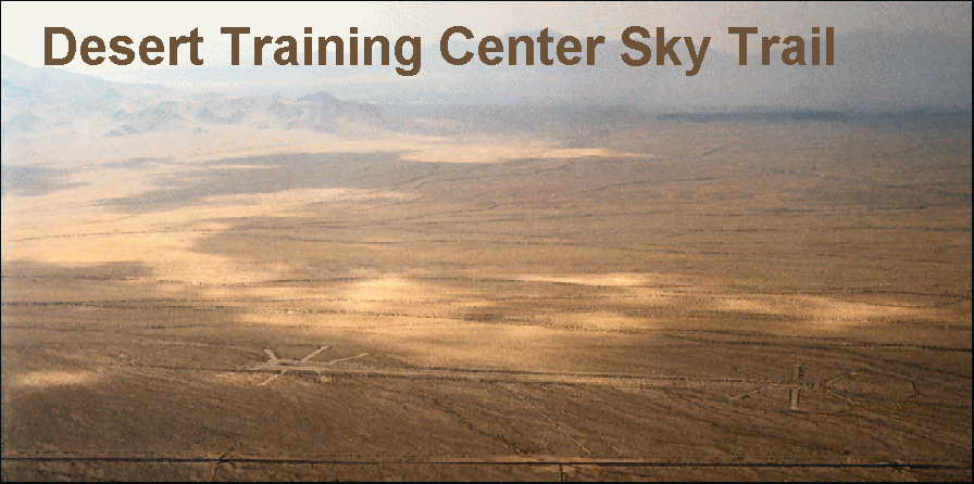
Established in the spring of 1942, Camp Iron Mountain was first occupied by the 3rd Armored Division. Its 23rd Armored Engineer Battalion constructed 40 miles of camp roads, along with firing ranges. By late
|
| Camp Iron
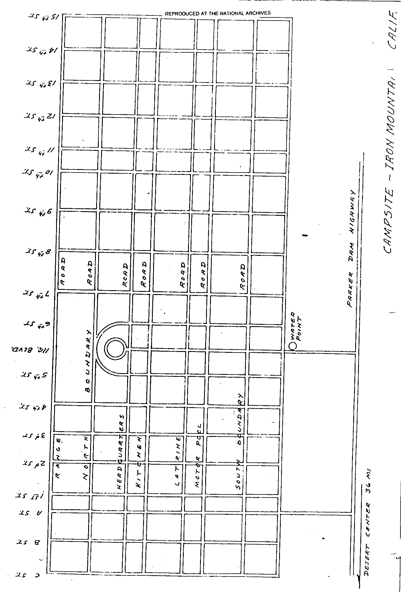
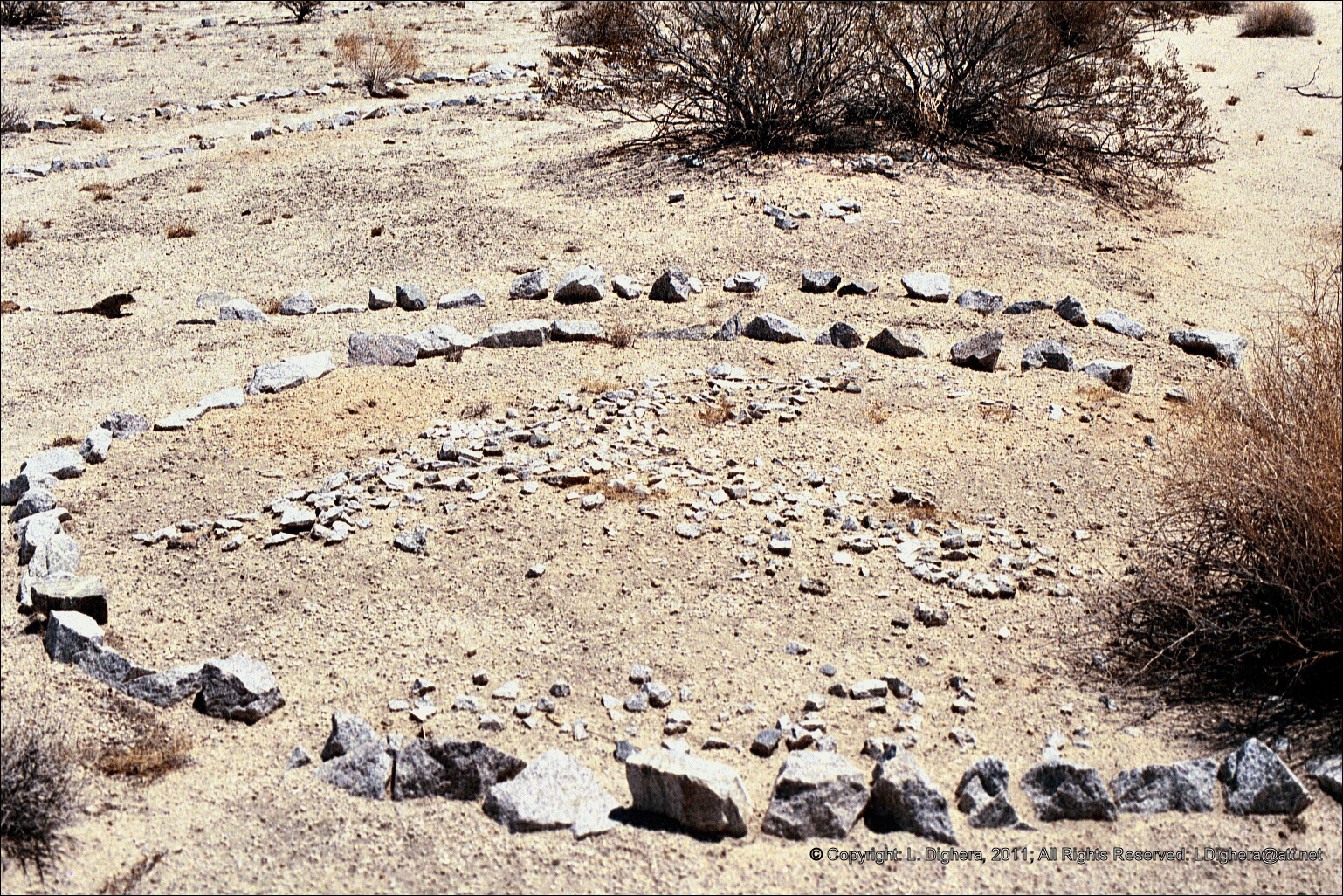
Mountain street layout The rock-lined street layout of Camp Iron Mountain typifies the divisional campsites with its headquarters circle surrounded by a semicircular road off which the administrative tents were arranged. |
in the summer of 1942, the entire division had taken over the camp. Camp Iron Mountain was also
home to the 183rd Artillery Group, the X Corps
Artillery, and the 951st Artillery Battalion between
mid-1942 and mid-1944 (BLM 1984; RP-E, 11 September
1984: B-1). The 54th Evacuation Hospital was
at Camp Iron Mountain from October 15 to November
27, 1943.
During maneuvers conducted between August 29
and September 13, 1942, the Director Headquarters
and Advisor's Camp was located at Camp Iron
Mountain. These maneuvers involved the 3rd Armored
Division, 7th Motorized Division, 5th Armored
Division, 75th Field Artillery Brigade, and
elements of the VII Corps (BLM 1984). It is likely
that many maneuvers were planned at Camp Iron Mountain, with the benefit of
its large relief map.
Current Condition
Perhaps the best-preserved divisional camp, Camp Iron mountain has also
received the most public attention. The two outdoor chapels remain;
one of these (the smaller of the two) was reportedly a Protestant chapel,
the other a Catholic chapel. Smoke trees stood on either side of the
Catholic altar, and rocks formed a kind of sanctuary in front, with a
pathway leading to the altar. The pathway was reportedly lined with
cacti. The Protestant chapel, at least
according to an old photograph, was used by
some soldiers of the 183rd Field Artillery Group.
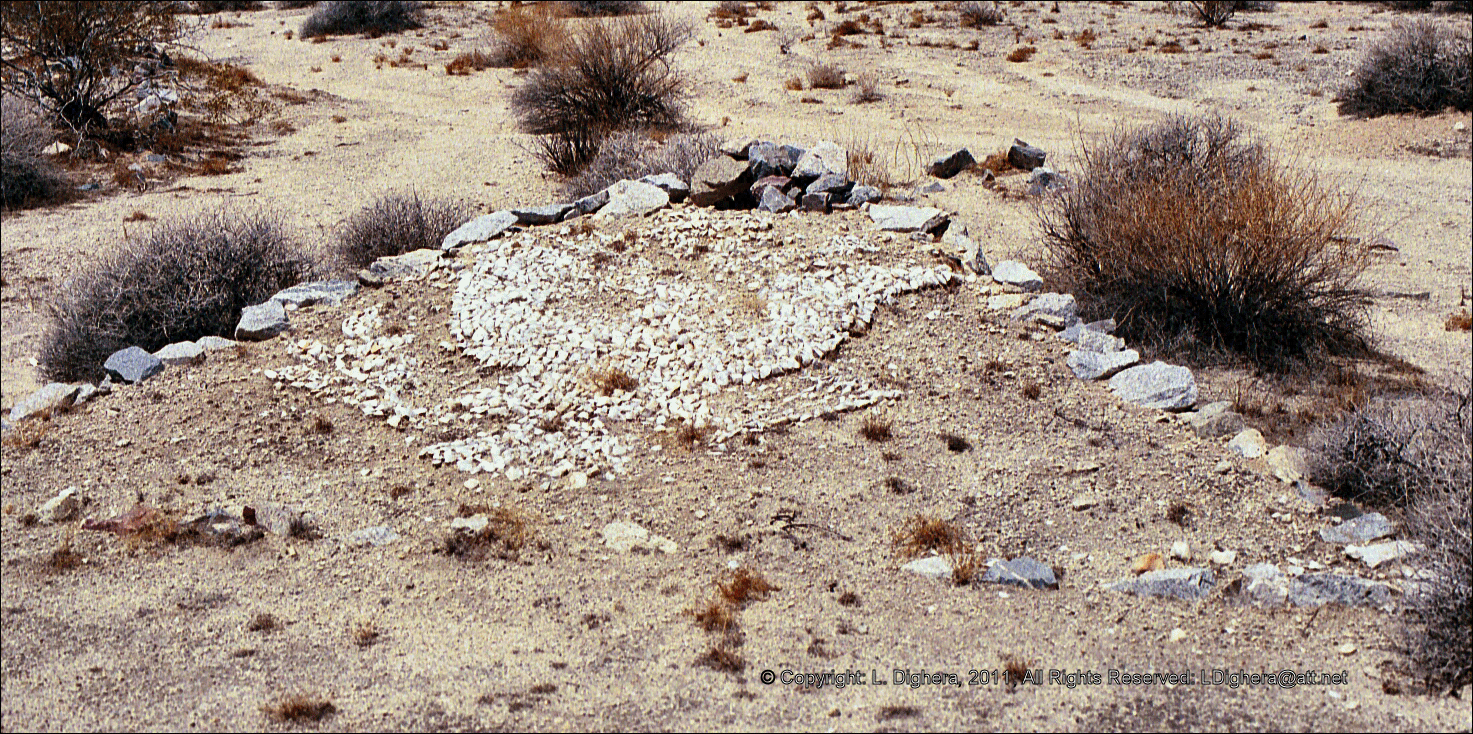
Rock inlays in the concrete could apparently be seen
in 1973, forming the numbers of the 183rd and the
951st Field Artillery Battalions (MWD 1973). The
Protestant chapel also had a small sanctuary in front,
with rock-lined walkways. A small cross formed by
the placement of rocks in the ground could also be
seen in 1973 (RP-E, 28 January 1973: C-1-C-8).
Also present at Camp Iron Mountain was a large
relief map measuring 200 by 175 feet,
built
 by the U.S. Army Corps of Engineers. The
map represented the entire DTC/C-AMA area, from
roughly Kingman to Twentynine Palms, and from
Hoover Dam to the Coachella Valley. Built completely
to scale, the map included a wooden walkway
spanning its entire distance. The
walkway was still extant as late as 1977, although
it is gone today (Weight 1977). The map included
small wooden signs indicating large topographic
features, as well as divisional camps. Highways, railroads, and the MWD
aqueduct were also represented
(RP-E, 28 January 1973: C-1-C-8). The BLM has fenced off this feature
to prevent further vandalism and has dug a diversion channel uphill to
prevent erosion.
by the U.S. Army Corps of Engineers. The
map represented the entire DTC/C-AMA area, from
roughly Kingman to Twentynine Palms, and from
Hoover Dam to the Coachella Valley. Built completely
to scale, the map included a wooden walkway
spanning its entire distance. The
walkway was still extant as late as 1977, although
it is gone today (Weight 1977). The map included
small wooden signs indicating large topographic
features, as well as divisional camps. Highways, railroads, and the MWD
aqueduct were also represented
(RP-E, 28 January 1973: C-1-C-8). The BLM has fenced off this feature
to prevent further vandalism and has dug a diversion channel uphill to
prevent erosion.
 |
| Camp Iron Mountain after a sandstorm |
Camp Iron Mountain was laid out in the same fashion
as the other divisional camps. Many
nonnative plants were placed to accentuate particular
features at the site. Plants, particularly smoke trees,
barrel cacti, and ocotillos, were planted throughout the
camp. Rocks were used to line walkways, company
areas, tents, supply areas, latrines, mess halls, chapels,
and many plants.
Reports of a grenade-throwing range near the camp
have been made. Grenade-container end caps were
found behind foxholes, which were located halfway
between the camp and the mountains to the
west. The camp dump was also reported in the
same account, farther away from camp toward the
mountains (Blake 1988: 33). Individuals have reported
finding crates containing antitank mines
buried near the camp (RPE, 28 January 1973: C-1-C-8).
Prior to the establishment of California Highway
62, the Iron Mountain area was extremely isolated.
This isolation protected the camp from the level of
vandalism it faces today. Even in the late 1970s,
artifacts could still be found in large numbers.
Rock-lined walkways and roads are clearly discernible
at Camp Iron Mountain, as are unit symbols
and other insignias. The relief map
is one of only three known to now exist and is by far
the best example. The two chapels
are also rare, the only other one being at Camp
Coxcomb. The chapels' altars are in excellent condition
thanks to efforts to preserve them.
After years of effort, monies were finally made
available to make portions of Camp Iron Mountain a
preserve in 1973. In 1979,
an environmental analysis record was completed,
and a fence and interpretive sign were erected
around the relief map. Unfortunately, the sign was
soon thereafter vandalized. In 1979, the Los Angeles MWD agreed to
dig the channel, with the volunteer labor of one of
their employees. Later, a cyclone fence was built
around the entire relief map (BLM 1984). the designation of Camp
Iron Mountain as an Area of Critical Environmental
Concern (ACEC). Designation of the camp as an ACEC
was part of a larger California Desert Conservation
Area plan finally implemented in 1980.
 Camp Iron Mountain relief map then |
 Camp Iron Mountain relief map June 1999 |
 Rock mosaic eagle insignia June 1999 |
 Rock mosaic June 1999 |
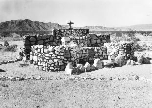 Alter at Camp Iron Mountain then |
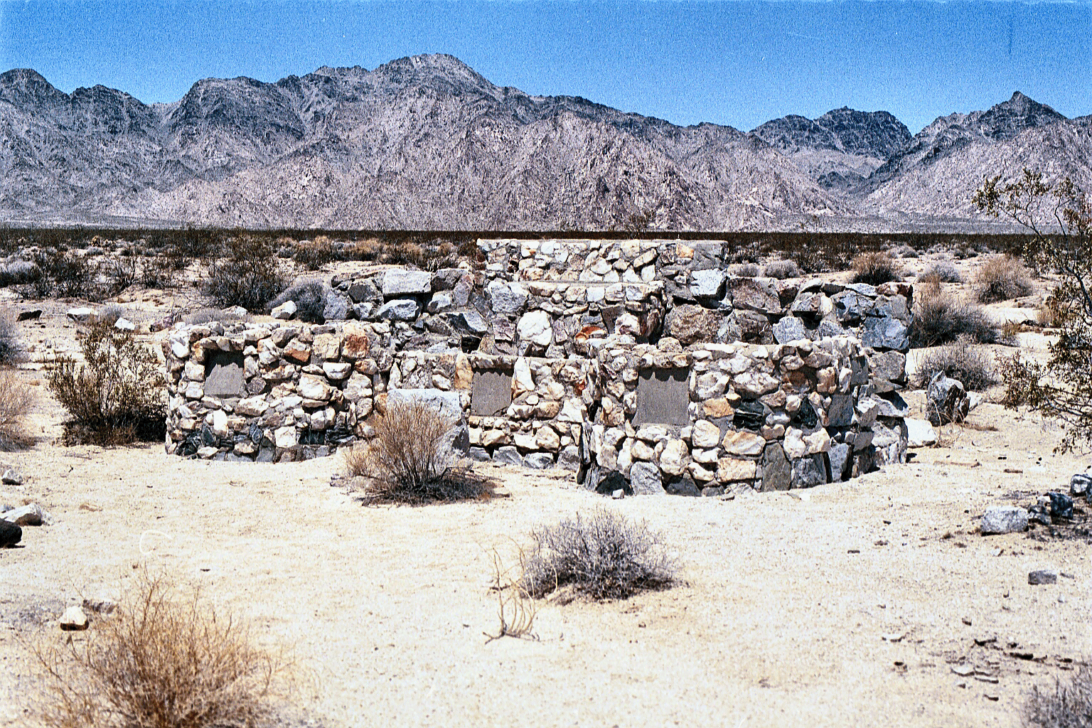 Alter at Camp Iron Mountain June 1999 |