 Photo: Camp Ibis looking toward the south
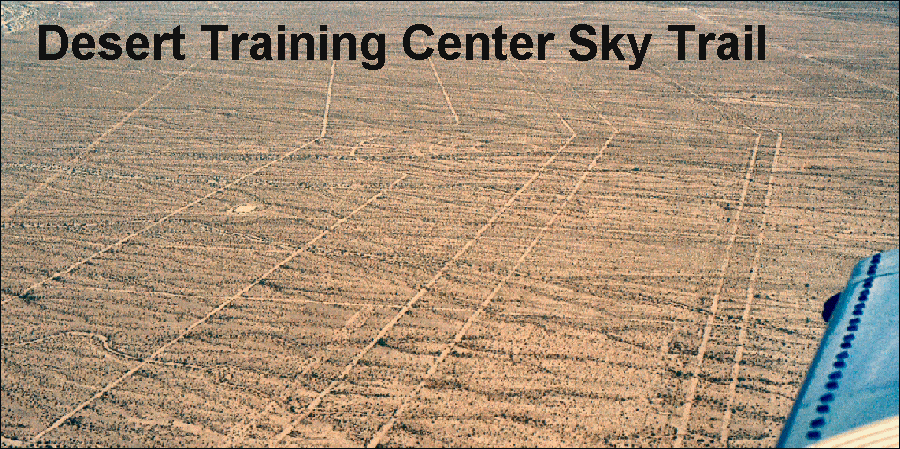
Camp Ibis was located along U.S. Highway 95, stretching more than 2 miles north to south.
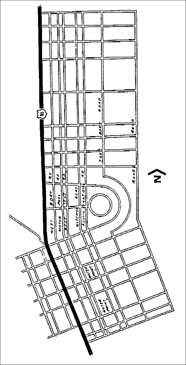 |
| Camp Ibis street layout The rock-lined street layout of Camp Ibis is unique with its bend to follow the contour of U.S. Highway 95. |
Constructed in winter 1942-1943, Camp Ibis was first occupied by the 4th
Armored Division. After the departure of the 4th in June 1943, the camp was occupied by the 9th Armored
Division from July to November 1943. The 9th Armored Division was replaced
by the 11th Division in winter 1943, which was the last division to occupy
the camp (Meller 1946 :41-42).
Most of the divisions placed signs indicating their presence at the camps. The 11th Division was no exception, placing a sign over the main road into
Camp Ibis.
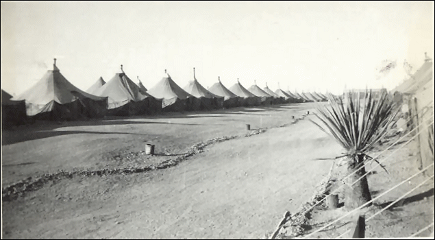
Temporary facilities at Camp Ibis consisted of 28 shower buildings for
enlisted men and 14 for officers; 173 latrine buildings; 97 single, 127
double, and 100 triple wooden tent frames; a 50,000-gallon, concrete water
reservoir; and a 50,000-gallon, wooden, elevated storage tank. In addition,
the camp contained 23 ranges, including ones for moving targets, pistols,
rifles, and .50-caliber machine guns. There were also several combat ranges,
vehicle combat ranges, and transition courses. A POW camp, perhaps
associated with Camp Ibis, was reported to have existed near Searchlight
Junction, 1 mile south of Camp Ibis (Bard 1972 :139).
Supporting this report are indications that the largest area cleared of
ordnance lies immediately west of the Dead Mountains, which are located near
Camp Ibis
(BLM n.d.). [1: pp: 73]
Current Condition
Elements of Camp Ibis remain on both sides of U.S. Highway 95. That
portion lying to the east of the highway is the best preserved. Many
camp roads still exist, as do numerous rock-lined walkways and unit areas.
Rock insignias can also be found, including several consisting of groupings
of white quartz. Tank tracks have been found on the west side of the
highway, along with various items of refuse. A camp dump has been
reported to be north of the camp. The larger and more diagnostic
artifacts (e.g., dog tags) have been removed from the site. Because
the site is frequently used by people driving recreational vehicles for
overnight camping, many of the rock-lined roadways are disappearing.
Erosion is one of the culprits, although there is evidence that many of the
rocks have been moved by visitors. Fire rings are a common end for
many of these walkway stones.
 |
 |
 |
||
| Mess | Tents | Roads |
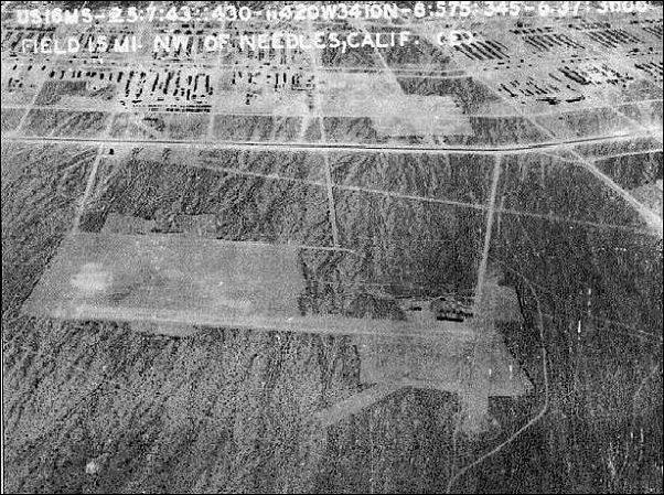
Camp Ibis Army Airfield
The airstrip is located west of
U.S. Highway 95 across from the campsite. It was reported to have one
2500' X 150' runway at an elevation of 2000'.
 |
 |
 |
||
| Ibis Army Airfield looking north | Ibis Army Airfield looking east | Camp Ibis Airstrip today |